Karabük
Karabük

Karabük
Karabük is situated on an important trade route between Amasra on the coast and central Anatolia. Karabük is a town and the capital district of Karabük Province in the Black Sea region of Turkey. Karabük was built in the 1930s as the seat of the iron and steel industry of Turkey. There are no known records of the origin of its name; in Turkish kara means “black” or “land” and bük means “bush” or “blackberry bush” (“bramble”). So Karabük means “blackbush”. It has borders with the cities Kastamonu on the east and northeast, Bartın on the northwest, Zonguldak on the west, Bolu on the southwest and Çankırı on the southeast.
History

Karabük had become a province of Zonguldak during the early years of Turkish Republic in 1927. Formerly it was small village of Safranbolu, formed by 13 houses. There was a train station which started to be called “Karabük” in June 1st, 1934. After the foundation of the Iron – Steel Factory in 3 April 1937, Karabük started to grow rapidly and its name became popular all around Turkey. In 1953, it became a district of Safranbolu and later in 1995 Karabük became an official province center of Turkey. Hadrianapolis (now Eskipazar) is an ancient city from the Roman Empire of the 4th century, located about 3 km from Karabük. There are many fountains, churches, and Roman baths. Although most of it is recently excavated, illegal excavations which have been going on for many years have damaged Eskipazar’s chances of becoming a major tourist attraction.
Climate

The climate of Karabük is a combination Black Sea climate and terrestrial climate. The area closer to the sea shows effects of Black sea coast. Other parts in Central Anatolia are mostly very cold in winters and hot and dry in summers.
Places of interest

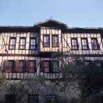
Safranbolu Houses The most important element, which brought Safranbolu forward in our country and in the world at the scope of the culture tourism, is the Safranbolu houses constructed in the style of the traditional Turkish architecture. These houses are attractive both in the scope of urban positions and their architecture styles. There are approximately 2000 traditional Turkish houses at the district center constructed at the beginning of 18th and 19th century.
The houses are grouped in two different regions of the Safranbolu district. The first region is the winter residence known as the city and the second region is the summer residence known as bağlar (orchard).
Ancient Cities As a result of the archeological excavations and studies executed in the Karabük province the ruins of the ancient Hadrianapolis city had been discovered inside the borders of the Eskipazar district which was assumed to be founded in BC 64, in the Roman civilization period. Another important settlement area belonging to this ancient city is Kimistene, located at the Asar Hill.
There is an ancient settlement belonging to the Roman civilization period at the Akören village of Safranbolu district.
There are 32 normal sized and 4 large sized tumulus inside the borders of the Karabük Province.
Religious Monuments The important mosques and churches of Karabük Province would be counted as St. Stefanos Church (Ulu Mosque) located in Safranbolu district, Eski Mosque (Old Mosque)(Gazi Süleyman Paşa Mosque), Köprülü Mehmet Paşa Mosque, Hidayetullah Mosque, Taş Minare Mosque (Stone Minaret Mosque), Dağdelen Mosque, İzzet Mehmet Paşa Mosque, Akçasu Mosque and Küre-i Hadit Mosque located in Eflani District.
InnsCinci Inn: The inn is located at the Çeşme Quarter of Safranbolu District at the middle of the bazaar. This magnificent structure is constructed his hometown, Safranbolu by the Rumeli Kazaskeri Cinci Hoca (Real name Hüseyin), who had gained power and became rich during the period of Sultan İbrahim.
There are two other inns other than Cinci inn in Safranbolu named Pamukçu and Tuzcu Inns. The Katırcı Inn located in the Eflani district , which was constructed by the beginning of 20th century.
BathsEski Hamam (Old Bath): The bath is located in the Çeşme quarter of the Safranbolu district. It was from the Byzantine period.
Yeni Hamam (New Bath) (Cinci Bath): The bath is located in the Çeşme quarter of the Safranbolu district inside the Bazaar. This bath was also constructed by Cinci Hoca.
Yazıköy Bath: The bath is located inside the borders of Safranbolu District and the exact date of construction is not known. It is estimated to be constructed in the mids of 1800.
Bulak Bath: The bath is located in the Karabük province and the exact construction date is not known. It is estimated to be constructed in the year of 1780. It is a creation of the Ottoman period.
Fountains There are 93 officially registered fountains with and without inscriptions as cultural riches in the Safranbolu district.
Taşköprü: The bridge is located to the east of Safranbolu district and 200 meters north of Konarı village. The bridge is constructed over the Eflani Creek and the exact construction date is not known.
BridgesTokatlı Bridge The bridge is located at the Aşağı Tokatlı Quarter of Safranbolu district. The construction date is assumed to be the 18th century.
HighlandsSorkun Plateau: The Sorkun Plateau is located inside the borders of Karabük – Yenice – Eskipazar and has an approximate altitude of 1650 meters. The plateau has a vast area and is available for trekking purposes.
Ulu Plateau: The Ulu Plateau is located at the north of Safranbolu district and is covered with abundant forests with vast and green meadows. The combination of wooden plateau houses and forests exposes a paradise like adobe. The plateau is suitable for camping and trekking purposes.
Sarıçiçek Plateau: The plateau is located inside the borders of Safranbolu district and has an altitude of 1700 meters. The plateau is covered with forests. The plateau is suitable for trekking, horse riding, mountain bike riding and camping.
Boduroğlu Plateau: The plateau is located in the Ovacık district and has an unmatched beauty. Every year festivals are arranged in the plateau.
Caves and CanyonsBulak (Mencilis) Cave: This cave is located at the Bulak village. With its 6,5 km length, it is the 4th largest cave of our country. The cave is a natural wonder with its stalagmites, stalactite travertine, small lakes and underground river.
Other various caves inside the city borders are the cave located in the Sipahiler village reached via 61 stairs and the Hızar cave located inside the borders of Safranbolu district.
Canyons: The canyons hold a peculiar place among the natural beauties of Karabük. The canyons are mostly formed by the deep cracking of limestone layers in Safranbolu Region. These canyons made the land structure of the region interesting and the most important canyon of the region is the İnce Kaya canyon. This canyon hosts the İnce Kaya water arch and has very steep and deep slopes.
The Düzce (Kirpe) Canyon charms and fascinates its visitors with the natural beauties. The length of the canyon is extremely long. Other canyons of the province are Tokatlı, Sakaralan and Sırçalı canyons. The Şeker Canyon at the Yenice district is another important canyon with 6.5 km length and hard passages and attracts professionals.
Promenade Göktepe Nature Park: This park is located in the Yenice district. It has advantages like natural beauties, suitable climate and clean air and convenient reaching. The plateau is suitable for sportive activities, camping and caravan tourism.
Gökpınar Relaxation Resort: This resort is located inside the poplar forest region of Yenice district, on a mountain peak called as Gökpınar plateau.
Çetiören Promenade Place: This promenade place is located at 10 km. distance to the Eskipazar district. The area has rich fauna and flora and wild life. The area has unique beauties. The music and oiled wrestling festival is arranged at the second weekend of August each year..
Eğriova Promenade Place: This promenade place is located at 25 km distance to Eskipazar district in the locality of Eğriova with 12.000 m2 surface area and an artificial lake with 5 m. depth. It is a suitable place for trekking and camping purposes.
Eflani locality: This area has broad plains and plantation.
Museums There is no official museum established in the Karabük province. The “Iron – Steel Museum” belonging to Kardemir, “Ahmet Demirezen Yemenicilik Museum” in Safranbolu and some Safranbolu Houses (Kaymakamlar House, Kileciler House, Karaüzümler House, Mümtazlar Mansion) restored and open to visit by Ministry of Culture, Head Official of the district and private persons are serving as museum.
Iron – Steel Museum: The museum was established in the Yenişehir quarter in 3 April 1984. The museum introduces the foundation of Iron – Steel Factories, first iron production, and technological improvement with photographs and materials.
Ahmet Demirezen Kerchief Artisanship Museum: The museum was arranged by Kerchief Artisan Ahmet DEMİREZEN in the Safranbolu Kerchief artisans bazaar section, 3 numbered shop. The equipment and materials used in the production of shoe called Yemeni are exhibited in the museum and was founded in 1989.
Kaymakamlar Museum House: The house is located on the Çarşı Hıdırlık Ascension Street of Safranbolu district. This museum is nationalized and founded from a splendid Safranbolu house in the scope of “Safranbolu Improvement and Preservation” project of Ministry of Culture in 1979 and had been restored and arranged. The house had entered service in 1981 as Education Center and Museum House and had been named as Kaymakamlar House because of its former owner. It is open for visit in daylight hours.
Activities
 Camping at the Yenice Forests in Autumn and enjoy the nature.
Camp in Ulu Plateau and Sarıçiçek Plateau and visit Şeker Canyon and Düzce Canyon.
Do fishing at the Eflani Small lakes.
Do trekking in the Sorkun Plateau, Ulu Plateau, Sarıçiçek Plateau, Boduroğlu Plateau, Avdan Plateau and the Tokatlı and Düzce Canyons passing through the Safranbolu district.
Photo Gallery
- Karabük – Safranbolu
- Karabük – Safranbolu
- Karabük – Safranbolu
- Karabük – Safranbolu
- Karabük – Safranbolu
- Karabük – Safranbolu
- Karabük – Safranbolu
- Karabük – Safranbolu


